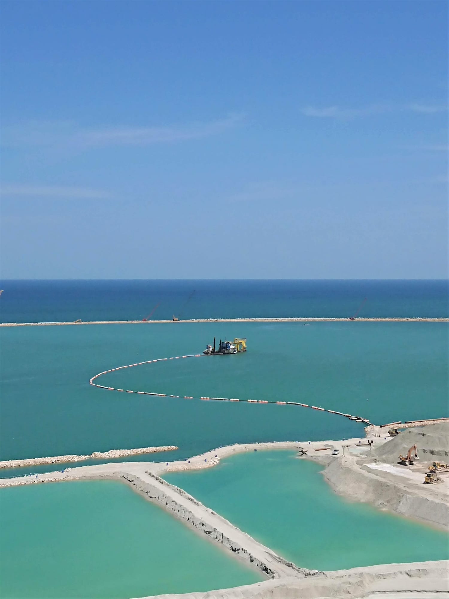
Islands, airport runways, waterfront communities and port terminals across the region stand on land that was once seabed. If you are planning a project that needs new land from the sea, it helps to understand how that land is actually made. The process follows a clear sequence, and most of the cost, risk and programme decisions are settled in the first few steps, long before any sand is pumped.
Gulf Cobla has been reclaiming land across the region for more than four decades. Here is how a typical project moves from the first survey to finished ground.
Step 1: Define what the land has to do
Every reclamation project starts with a simple question: what will this land be used for? A residential island, a runway, a port yard and a beach park all need different things. The answer sets the area, the finished ground level above the sea, and how much load the ground has to carry.
These requirements become the design brief. They decide how much fill is needed, what quality of material is acceptable, and how the edges of the new land will be protected from the sea.
Step 2: Survey the site and the seabed
Before anyone can plan the works, they need an accurate picture of what is under the water. A bathymetric survey maps the seabed depth and shape across the reclamation area. From that, the team can work out how much material it will take to bring the area up to the design level.
Our in-house survey department carries out this work with multibeam (MBES) and single beam (SBES) echosounders, GNSS positioning and motion sensing. The outputs include bathymetric maps, 3D models, cross sections and volume calculations. The same team keeps surveying throughout the project, so progress is measured against the design rather than estimated. You can read more on our survey services page.
Alongside the bathymetry, the design team will want to know about the ground beneath the seabed. Soft layers under the reclamation area affect how the new land behaves once it is loaded.
Step 3: Find the fill
Most reclamation in the region is built with sand. The sand has to come from somewhere, and the choice of source has a big effect on cost.
One option is a borrow area: a part of the seabed where suitable sand is dredged purely to supply the reclamation. The other, where the project allows it, is to reuse sand from dredging that has to happen anyway, such as deepening a channel or creating a marina basin. Wherever possible, Gulf Cobla reuses sand from deepening waterways and ports for reclamation. It means one operation does two jobs.
On the Sobha Al Siniya project in the UAE (2024 to 2026), dredging and reclamation are being carried out together, with 8.4 million m³ in scope and 8 million m³ delivered so far.
Step 4: Contain and protect the edges
Sand pumped into open water will simply spread out. So before or during filling, the new land needs a boundary. Depending on the design, that can be a bund, a rock revetment, a sheet pile wall or another form of shore protection.
The edge also has to stand up to waves and currents for the life of the project. On the Velana International Airport reclamation in the Maldives (2016 to 2017), shore protection formed part of the scope alongside 5.5 million m³ of reclamation.
Step 5: Pump the sand into place
This is the stage most people picture when they think of reclamation. A cutter suction dredger loosens the sand on the seabed and pumps it, mixed with water, through a pipeline to the reclamation area. The sand settles, and the water drains away.
There are several ways to get the material where it needs to go. It can be pumped ashore through floating or submerged pipelines. It can be sprayed directly onto the area from the dredger, a method known as rainbowing. Or it can be carried by split hopper barge and dropped at a set location. The choice depends on distance, water depth and how precisely the material has to be placed.
The size of the dredger matters too. Our fleet of cutter suction dredgers runs from Khaleej Bay, at 7,000 hp, down to smaller units for tighter sites.
Step 6: Shape the land to its final level
Once enough sand is in place, the surface is profiled and formed to the required ground levels and slopes set in the design. This is where the reclaimed area starts to look like land rather than a sand fill.
Depending on what will be built on top, the design may also call for ground improvement to make the fill denser and reduce later settlement. That requirement comes from the project engineers and should be agreed early, because it affects the programme.
Step 7: Check the result
The last step is proof. A final as-built survey confirms that the levels, areas and volumes match the design. These records matter to the client, the engineer and anyone who builds on the land later. Our survey team produces the as-built data, including cross sections and volume calculations.
Examples from our project record
Gulf Cobla’s reclamation work covers islands, airports, residential developments and infrastructure:
Mussafah South Channel, Abu Dhabi (1981 to 1983): 44 million m³, including three reclaimed islands.
Amwaj Islands, Bahrain (2001 to 2003): four of the six islands reclaimed.
Al Raha Beach, Abu Dhabi (2009 to 2012): reclamation for 11 precincts.
Skydive Dubai runway, Dubai (2011 to 2012): 1.5 million m³ for a runway causeway, completed in nine months.
Gan International Airport, Maldives (2013 to 2014): 1 million m³ for a runway extension.
Velana International Airport, Maldives (2016 to 2017): 5.5 million m³ reclaimed, with shore protection.
What to have ready before you speak to a contractor
The intended use of the new land and the finished ground level.
The area to be reclaimed, with any site boundaries.
Existing survey or ground investigation data, if you have it.
Possible fill sources, including any dredging nearby that could supply sand.
Programme limits, such as deadlines tied to construction on the new land.
Talk to us about your reclamation project
Gulf Cobla’s quality management system is certified to ISO 9001:2015, covering dredging and land reclamation, marine charter and survey services. We handle the full process in house, from the first survey through dredging and filling to the final as-built check.
See our land reclamation services, browse our projects, or contact us to discuss your project.